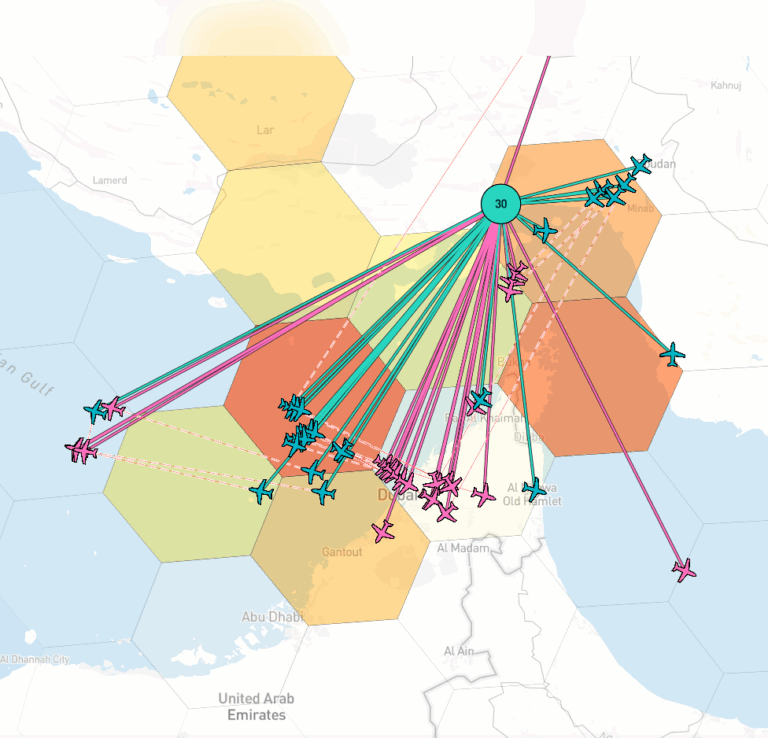
Since the escalation of the Israel-Hamas conflict, reports on GNSS jamming events have significantly picked up in the Middle-East, impacting airlines in the region.
Satellite navigation provides our society with a precise position and a precise time. This is useful for many civilian applications, but also for many military operations. Where two decades ago, usage of GNSS guided weapon systems was limited to advanced militaries, nowadays, commercial GNSS guided drones are used for reconnaissance operations or even attacks.
As such, combatants attempt to counter drone strikes by jamming or spoofing GNSS signals. With commercially available programmable radios, such as the HackRF, it is possible to simulate GNSS signals and send drones off-track. Various reports have identified strong jammer signals coming from a Russian base in Syria, causing mainly GPS interference in the region, although Galileo-based receivers will also be impacted on the shared L1 frequency.
GNSS jamming is not new to the region, and airlines have been impacted for a longer time. On the 15th of October, Israeli military issued a warning that GPS usage is restricted within two kilometers of active combat zones, indicating an increase in GNSS interference efforts, by either Israel and/or Hamas.
Where previously jamming was the largest concern, recently, the ADS-B data coming from aircraft have been seen to teleport or fly in circles, indicating spoofing efforts in the region. GNSS jamming and spoofing has put civil aviation at risk, causing the Tel Aviv airport for example to dispatch 49 Notice-To-Airmen (NOTAM) warnings in 2021 alone. Now, one question arises, did jamming actually increase over outbreak of the conflict? This question is difficult to answer, as there is no standardized data available yet over the number and severity of GNSS interference events. The most insightful data currently available comes from gpsjam.org, which reports daily maps of GPS interference. It can be seen that there is less data available over Syria, Gaza and Lebanon, indicating rerouting of aircraft trajectories away from these regions. If the amount of interference has actually increased since the outbreak remains inconclusive, but GNSS interference has been a problem before the war, and remains to be a problem today.
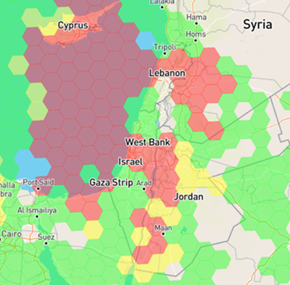
02/16/2022
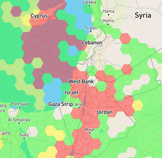
10/29/2023